Geologic Map of Saipan, Mariana Islands 1:12,500, 1954
Permanent URI for this collection
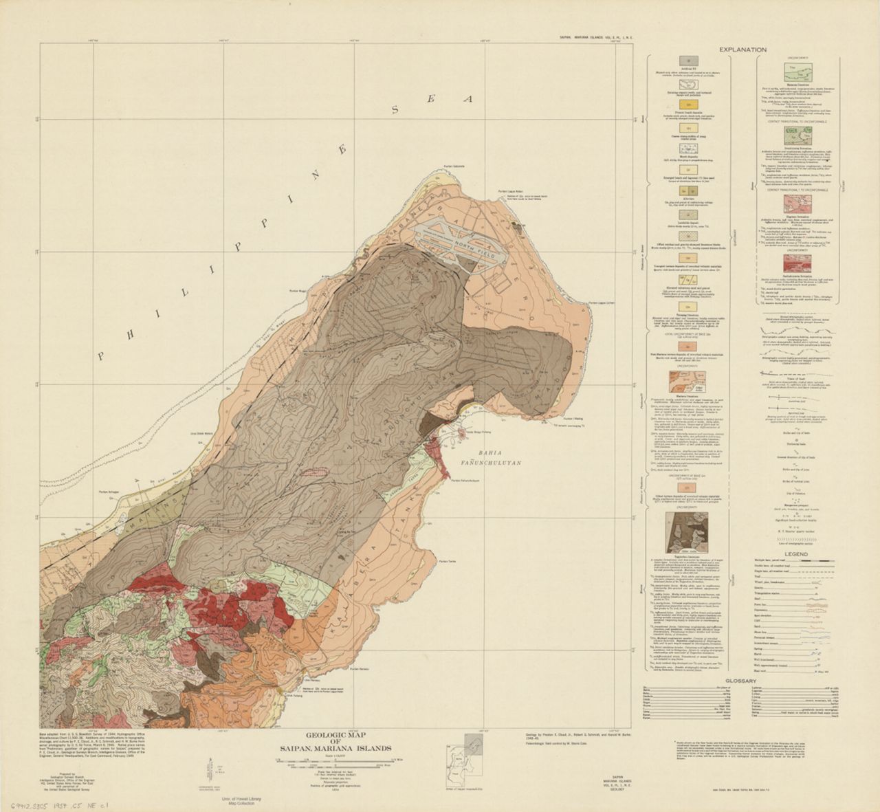
Geologic Map of Saipan, Mariana Islands. Scale 1:12,500 ; polyconic projection (E 145°41ʹ00ʺ--E 145°50ʹ10ʺ/N 15°18ʹ30ʺ--N 15°05ʹ30ʺ). 1 map on 4 sheets : color ; sheets 90 x 98 cm. Relief shown by contours. "Form line interval 40 feet (20 feet interval where dashed). Datum is mean sea level." At upper and lower right: "Saipan, Mariana Islands, Vol. II, Pl. 1, [Sheet], Geology." "Prepared by Geological Surveys Branch, Intelligence Division, Office of the Engineer, HQ, United States Army Forces, Far East, with personnel of the United States Geological Survey." "Base adapted from U.S.S. Bowditch Survey of 1944; Hydrographic Office Miscellaneous Chart 11,500-36." "64th Engr. Bn. (Base Topo) Bn. 1905 4/54 7 C." Includes index map. Accompanies text: Military geology of Saipan, Mariana Islands / Intelligence Division, U.S. Army Far East Command. 1955-1959.
Click here for an interactive index map to this set.
For more information, visit Manoa MAGIS
Browse
Recent Submissions
-
ItemGeologic Map of Saipan, Mariana Islands, S.W. Sheet.(Place of publication not identified : Geological Surveys Branch, Intelligence Division, Office of the Engineer, HQ, United States Army Forces, Far East, 1954)
-
ItemGeologic Map of Saipan, Mariana Islands, S.E. Sheet.(Place of publication not identified : Geological Surveys Branch, Intelligence Division, Office of the Engineer, HQ, United States Army Forces, Far East, 1954)
-
ItemGeologic Map of Saipan, Mariana Islands, N.W. Sheet.(Place of publication not identified : Geological Surveys Branch, Intelligence Division, Office of the Engineer, HQ, United States Army Forces, Far East, 1954)
-
ItemGeologic Map of Saipan, Mariana Islands, N.E. Sheet.(Place of publication not identified : Geological Surveys Branch, Intelligence Division, Office of the Engineer, HQ, United States Army Forces, Far East, 1954)